
An Eleuthera road trip: the Queen's Highway from north to south
Eleuthera is made for driving. One road, the Queen's Highway, runs the length of an island about 110 miles long and often less than two miles wide, with the Atlantic on one side, the calm bank on the other and a beach down almost every side track. This itinerary follows it from north to south and can be done in a long day or, far better, spread across a stay.
By BahamasBooking editorial team. Updated . 3 minute read.
Before you set off
Fly into North Eleuthera (ELH) for the northern half and Harbour Island, Governor's Harbour (GHB) for the centre, or Rock Sound (RSD) for the south, and book a rental car for the airport you arrive at; fleets are small and sell out in winter. Bahamians drive on the left, mostly in cars with the steering wheel on the left. The road is paved but uneven in places, fuel stations are few and some close on Sundays, and there is little lighting after dark. Fill up when you can and plan to be where you are sleeping by dusk.
Driving the full length takes around three hours without stops. The sights below run north to south; reverse them if you are based in Rock Sound.
The north: Preacher's Cave to the Glass Window
Start near the top of the island at Preacher's Cave, where the Eleutherian Adventurers are said to have sheltered after their ship was wrecked on the Devil's Backbone reef in 1648; the beach beside it is long and usually empty. From the docks nearby, water taxis cross to Harbour Island and to Spanish Wells, each worth a day of its own.
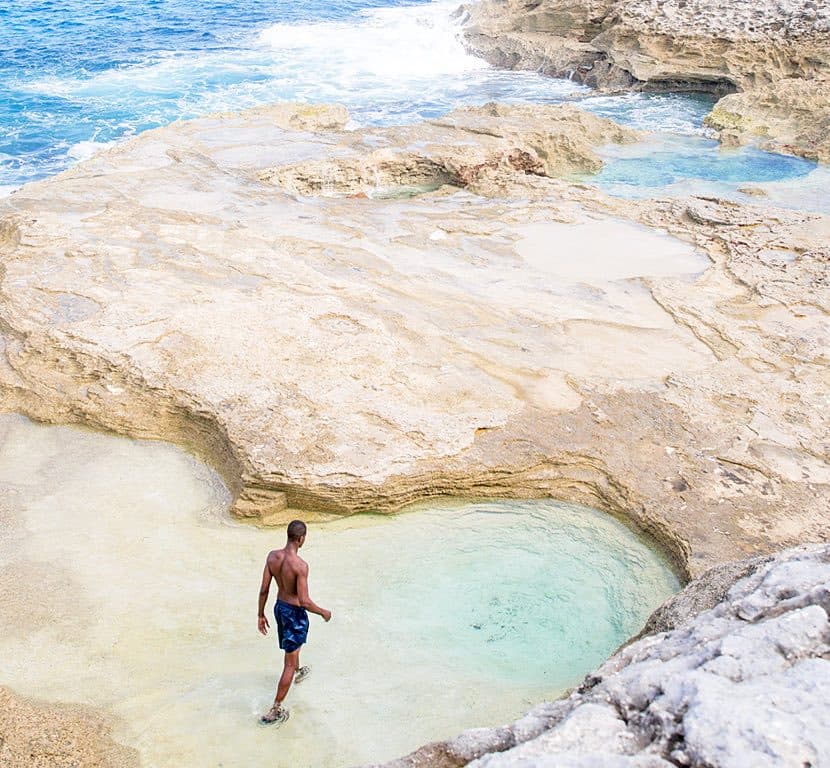
South of the airport the island narrows to a sliver at the Glass Window Bridge, where the dark Atlantic and the pale turquoise bank are separated by a few metres of rock. Park well back, do not walk onto the bridge in heavy seas, and look at the colours from the rocks on either side. A short drive on, the Queen's Baths are tide pools worn into the Atlantic shore; they are safe to bathe in at low tide and dangerous at high tide or in swell.
Gregory Town and Hatchet Bay
Gregory Town is the centre of Eleuthera's pineapple farming and hosts the Pineapple Festival each June. Surfer's Beach, down a rough track south of town, catches Atlantic swell in winter. Hatchet Bay has the island's most sheltered harbour, carved through the rock, and a large cave system inland with a ladder descent and bats; take a torch and a guide if you want to go beyond the entrance chamber.
Governor's Harbour and the centre
Governor's Harbour is the island's administrative centre and its prettiest settlement, with colonial houses climbing the hill above the bay and a Friday night fish fry on the waterfront. French Leave Beach, across the island on the Atlantic side, is a long pink-tinged stretch reached by a short road from town. Continuing south, Ten Bay Beach on the bank side is shallow, calm and good for children, and the settlements of Palmetto Point and Savannah Sound have small restaurants and some of the island's rental homes.
The south: Rock Sound to Lighthouse Beach
Rock Sound is the main town in the south, with a supermarket, the airport and the Ocean Hole, a deep inland blue hole in the middle of the settlement where fish rise to be fed. South of town the island quietens further through Wemyss Bight and Bannerman Town. The road ends, officially, at a long unpaved track to Lighthouse Beach at the southern tip: pink sand, limestone cliffs, the ruins of a lighthouse and water on three sides. The track punishes ordinary cars, so go slowly or with a high-clearance vehicle, bring water and shade, and allow time to walk the point.
- North: Preacher's Cave, Glass Window Bridge, Queen's Baths (low tide only).
- Centre-north: Gregory Town, Surfer's Beach, Hatchet Bay cave.
- Centre: Governor's Harbour, French Leave Beach, Ten Bay Beach.
- South: Rock Sound Ocean Hole, Lighthouse Beach.
- Fuel and daylight: fill up early, be off the road by dusk.
Want help turning this into a plan?
Send us your dates and the islands you are considering. We reply with a realistic route and real options, free of charge.